Cold Waters Tactical Map Guide
Tactical Map
The Tactical Map, and associated Mini-Map, provide an overview of the battle based on your submarine’s sensor data. This data is crucial to maintain situational awareness and stay in control of a battle as it unfolds. In addition, the Tactical Map is linked to your submarine’s weapon systems to provide targeting information.
Using The Map
Note that when using the mini-map, the mouse pointer must be over it in order to use pan and zoom.
Pan Map: LEFT CLICK and drag the mouse.
Zoom Map: MOUSEWHEEL or Equals and Minus.
Centre Map: Backslash will place your submarine in the center of the map.
Auto-Centre Map: Shift Backslash locks the map to your submarine. Maximize Map: Tab toggles between mini-map and full-screen map. Auto hides mini-map when switching to full screen.
Hide Mini-Map: LEFT CLICK in the upper portion of the mini-map hides/restore it. If you lose your submarine from the mini-map, maximize the map, drag your submarine to the center, then minimize the map.
The grid scale of the tactical map is shown in the upper right when in full-screen mode. The icons displayed on the map are as follows and are described in further detail below:
Vessel Positions
The map displays your submarine position and trail, which is always 100% accurate. LEFT CLICK on your submarine will move the camera to it.
Contacts are displayed based on their current target solution, namely how accurately their speed, course, and range have been determined. The better the solution (closer to 100%), the more accurate will be the displayed position of that contact. Once course is known, the icon will change so as to display that course, and once the solution is at a high enough level of confidence, that contact will be updated more frequently on the map as well as have a trail showing where it has traveled.
LEFT CLICK on contact will either;
1) select that contact.
2) if already selected, move the camera to that contact.
Torpedoes
If your sensors can detect a torpedo, it will be displayed on the map along with its trail. Player-fired torpedoes on a wire or straight running torpedoes are always displayed since their position does not require detection by your sensors.
If your sensors can detect a torpedo, it will be displayed on the map along with its trail. Player-fired torpedoes on a wire or straight running torpedoes are always displayed since their position does not require detection by your sensors.
Weapon Waypoints
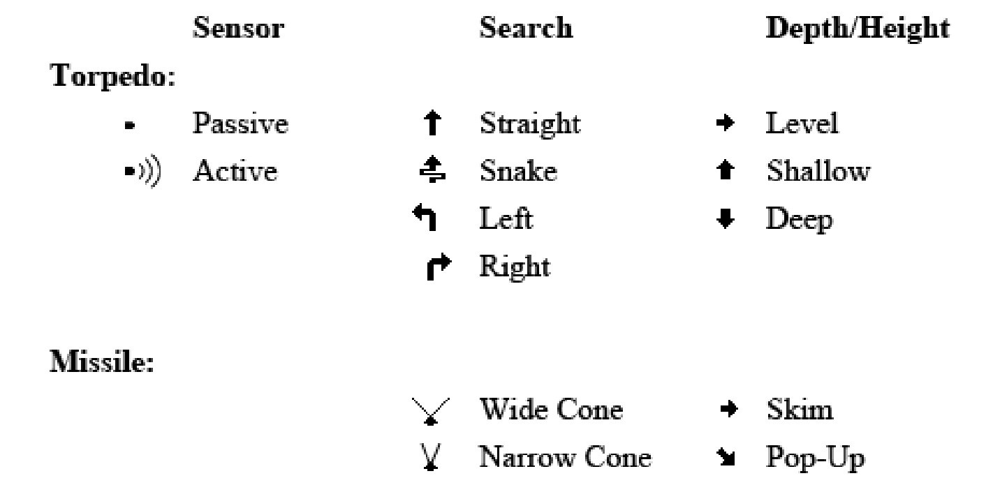
When firing a weapon, a waypoint must be set. Simply RIGHT CLICK (N) to place the waypoint at the current mouse position over the map. To edit a waypoint, LEFT CLICK (M) to pick it up and RIGHT CLICK (N) to place it at the current mouse position. Only weapons on an active wire may have their waypoint edited if they have not yet reached their waypoint and become activated.
Weapon Lead Indicator
When firing torpedoes, a lead indicator appears in front of the target to show the intercept point for that weapon. This can be used to assist with setting your waypoint. The lead indicator is only shown if the target solution is at maximum.
Noisemakers and Knuckles
Countermeasures dropped by vessels or disturbances in the water induced by putting the rudder hard to one side at high speeds (a knuckle) are also indicated on the Tactical Map. These interfere with torpedo homing.
Directional Indicators
Active sonar pings that your submarine can hear are displayed as a line from your submarine in the direction the ping was heard from. Such pings from other vessels or active sonobuoys dropped by aircraft and are displayed in yellow. Pings from terminal homing active torpedoes (friendly or enemy) are displayed in red. Whenever your ESM mast is extended, radar emissions from vessels or aircraft are displayed in a similar way to indicate the direction of the emitting source. These indicators are shown in purple.
Aircraft and Missiles
Airborne objects are not shown on the Tactical Map.
Ice and Mines
As ice and mines are detected by your high-frequency navigation sonar, they are mapped onto the tactical map. Ice may also be mapped by marking it with the periscope; see Sensors, Periscope section for more information.
Port
Shows the location of ports.
Deployment Zone
The circular area is used for Insertion missions to deploy special forces or in Land Strike missions to fire land-attack missiles into.
Map Boundary
Near the outside of the map is a red-shaded boundary that demarcates the limit of the combat zone. While it is possible for other vessels, aircraft, or weapons to move into this region, navigating your submarine here immediately ends combat. Ending combat in this manner does not require breaking contact with the enemy.


