Cities: Skylines – Bus Route Planning

Be on the way
In order to have a successful bus line, it should be planned carefully considering the city and network. At the start and end of your bus line, there should be main activity centers. The best areas to have are commercial areas, universities and landmarks. At these locations, it is vital to have an interchange to connect to other lines. In the space along the lines, there should be smaller activity centers such as schools, commercial, industrial and residential areas. By having job centers at the ends of the line and commercial and education at the ends, the bus line can be used well across the entire length of the line. The distribution of passengers should be equal throughout the line, to maximize efficiency.
Use the most direct route
With potential locations in mind, the path of the bus line should be the most direct route possible. If your city has a grid, running bus lines along the grid is a straight line is far more effective than an indirect and slow line. Lines should only be A-B and almost never loops. The main shapes to use are I, L, and U shapes.
The I shape offers a direct connection between two points using the straightest line possible.
The L shape is useful to connect areas off of the main corridor and in alternate directions.
The U shape is most useful for adding connections to connect other lines, and trips mostly along short sections of the line, rather than the whole line.
Example of a direct line
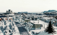
In this example, the bus line runs from left to right. On the right side, there is a city center and bus interchange. On the left side it ends at a commercial area in low-density residential. Along the line there is a University and schools as well as commercial zones along the main road. The line runs straight along the road and provides a fast direct connection from suburb to city.


